Floods and River Levels
River gauges at or above flood stage from the NOAA National Water Prediction Service, with active flood alerts.
Collected automatically and may be delayed. Not an official warning. In an emergency, call 911.
Turn around, don't drown. Never drive or walk into flood water. Six inches of moving water can knock you down, and one foot can carry a car away.
Flood alerts
Flash flood warnings 1All flood alerts 17
Rivers at or near flood stage
149 gauges · data from 10/26/2026, 2:42 PM CDT
Near flood stage 36Minor flooding 21Moderate flooding 15Major flooding 4
- Major floodingDevils Lake near Devils LakeNDStage 49.84 ft at 10/26/2026, 1:00 PM CDT · NWS office FGF
- Major floodingEastern Stump Lake near LakotaNDStage 49.82 ft at 10/26/2026, 1:15 PM CDT · NWS office FGF
- Major floodingTide Station at Ocean Reef on Card Sound (in MHHW)FLStage 2.33 ft at 10/26/2026, 2:48 PM EDT · NWS office KEY
- Major floodingTide Station near Manatee Creek on Barnes Sound (in MHHW)FLStage 2.71 ft at 10/26/2026, 2:42 PM EDT · NWS office KEY
- Moderate floodingBulow Plantation State Park (in MHHW)FLStage 2.13 ft at 10/26/2026, 2:42 PM EDT · NWS office JAX
- Forecast: Moderate floodingCooper River at Charleston Harbor (IN MLLW)SCStage 1.47 ft at 10/26/2026, 3:06 PM EDT · forecast crest 7.9 ft around 10/27/2026, 9:00 AM EDT · NWS office CHS
- Moderate floodingDunns Creek State Park Boat Ramp (in MHHW)FLStage 2.1 ft at 10/26/2026, 2:48 PM EDT · NWS office JAX
- Moderate floodingDunns Creek near Satsuma (in MHHW)FLStage 2.51 ft at 10/26/2026, 3:00 PM EDT · NWS office JAX
- Moderate floodingJulington Creek at Old Saint Augustine Road (in MHHW)FLStage 1.78 ft at 10/26/2026, 2:15 PM EDT · NWS office JAX
- Moderate floodingJulington Creek at St. Johns River Entrance (in MHHW)FLStage 2.13 ft at 10/26/2026, 2:54 PM EDT · NWS office JAX
- Forecast: Moderate floodingKipnuk Tide Gauge at Kipnuk (MHHW datum)AKStage -2.82 ft at 10/26/2026, 10:00 AM AKDT · forecast crest 3.34 ft around 10/30/2026, 4:00 AM AKDT · NWS office AFC
- Forecast: Moderate floodingKwigillingok Tide Gauge at Kwigillingok (MHHW datum)AKStage -5.43 ft at 10/26/2026, 10:00 AM AKDT · forecast crest 3.04 ft around 10/30/2026, 4:00 AM AKDT · NWS office AFC
- Moderate floodingMatanzas River at Bings Landing (in MHHW)FLStage 2.4 ft at 10/26/2026, 2:48 PM EDT · NWS office JAX
- Moderate floodingPellicer Creek at Faver Dykes State Park (in MHHW)FLStage 2.28 ft at 10/26/2026, 2:42 PM EDT · NWS office JAX
- Minor floodingForecast: Moderate floodingSan Juan River near BluffUTStage 25.92 ft at 10/26/2026, 12:30 PM MDT · forecast crest 30.97 ft around 10/26/2026, 3:00 PM MDT · NWS office GJT
- Moderate floodingSt Johns River at Welaka (in MHHW)FLStage 2.17 ft at 10/26/2026, 2:42 PM EDT · NWS office JAX
- Moderate floodingSt. Johns River at AstorFLStage 3.65 ft at 10/26/2026, 2:30 PM EDT · forecast crest 3.8 ft around 10/26/2026, 8:00 PM EDT · NWS office MLB
- Moderate floodingSt. Johns River at Buckman Bridge (I-295) (in MHHW)FLStage 2.08 ft at 10/26/2026, 2:30 PM EDT · NWS office JAX
- Moderate floodingSt. Johns River at Buffalo Bluff (in MHHW)FLStage 2.2 ft at 10/26/2026, 2:15 PM EDT · NWS office JAX
- Moderate floodingSt. Johns River at Racy Point (in MHHW)FLStage 2.45 ft at 10/26/2026, 2:30 PM EDT · NWS office JAX
- Moderate floodingSt. Johns River at Shands Bridge (in MHHW)FLStage 2.48 ft at 10/26/2026, 2:30 PM EDT · NWS office JAX
- Moderate floodingTide Station at Jewfish Creek on Florida Bay (in MHHW)FLStage 1.52 ft at 10/26/2026, 2:48 PM EDT · NWS office KEY
- Moderate floodingTrout Creek Marina near St. Johns River (in MHHW)FLStage 2.45 ft at 10/26/2026, 2:42 PM EDT · NWS office JAX
- Forecast: Minor floodingAtlantic Coast at Beaufort Marine Lab (in MLLW)NCStage 1.22 ft at 10/26/2026, 3:06 PM EDT · forecast crest 5.2 ft around 10/28/2026, 10:00 AM EDT · NWS office MHX
- Forecast: Minor floodingAtlantic Coast at Johnnie Mercers Pier at Wrightsville Beach (MLLW)NCStage 1.46 ft at 10/26/2026, 3:06 PM EDT · forecast crest 6.6 ft around 10/28/2026, 9:00 AM EDT · NWS office ILM
- Forecast: Minor floodingAtlantic Coast at Myrtle Beach Springmaid Pier (IN MLLW)SCStage 1.37 ft at 10/26/2026, 3:06 PM EDT · forecast crest 7.8 ft around 10/29/2026, 10:00 AM EDT · NWS office ILM
- Forecast: Minor floodingBarnegat Bay at Barnegat Light (IN MLLW)NJStage 0.65 ft at 10/26/2026, 3:00 PM EDT · forecast crest 3.6 ft around 10/27/2026, 9:00 AM EDT · NWS office PHI
- Forecast: Minor floodingBering Sea Tide Gauge at Teller (MHHW datum)AKStage 1.93 ft at 10/25/2026, 3:54 PM AKDT · forecast crest 4.76 ft around 10/27/2026, 11:00 AM AKDT · NWS office AFG
- Minor floodingBlack Creek (in MHHW)FLStage 1.82 ft at 10/26/2026, 2:48 PM EDT · NWS office JAX
- Minor floodingBlack Creek at MiddleburgFLStage 15.17 ft at 10/26/2026, 2:45 PM EDT · NWS office JAX
- Forecast: Minor floodingCape Fear River at Wilmington (IN MLLW)NCStage 2.3 ft at 10/26/2026, 3:00 PM EDT · forecast crest 5.8 ft around 10/27/2026, 10:00 AM EDT · NWS office ILM
- Forecast: Minor floodingCape May Harbor at Cape May Harbor (IN MLLW)NJStage 0.26 ft at 10/26/2026, 3:06 PM EDT · forecast crest 6.3 ft around 10/27/2026, 9:00 AM EDT · NWS office PHI
- Minor floodingCedar River at San Juan Ave Jacksonville (in MHHW)FLStage 1.51 ft at 10/26/2026, 3:00 PM EDT · NWS office JAX
- Minor floodingCoyote Creek (Marin) at Tam ValleyCAStage 7.62 ft at 10/26/2026, 12:00 PM PDT · NWS office MTR
- Minor floodingCrescent Lake at Crescent City (in NAVD88)FLStage 2.45 ft at 10/26/2026, 2:42 PM EDT · NWS office JAX
- Minor floodingDeep Creek at Spuds (in MHHW)FLStage 1.84 ft at 10/26/2026, 2:45 PM EDT · NWS office JAX
- Forecast: Minor floodingDelaware Bay at Lewes (IN MLLW)DEStage 0.38 ft at 10/26/2026, 3:06 PM EDT · forecast crest 6 ft around 10/27/2026, 10:00 AM EDT · NWS office PHI
- Minor floodingGeorgetown (in NAVD88)FLStage 2.67 ft at 10/26/2026, 2:42 PM EDT · NWS office JAX
- Forecast: Minor floodingGreat Egg Harbor Bay at Ocean City (IN MLLW)NJStage 0.37 ft at 10/26/2026, 2:24 PM EDT · forecast crest 5.4 ft around 10/28/2026, 10:00 AM EDT · NWS office PHI
- Minor floodingIndian River at Wabasso (in MHHW)FLStage 2.18 ft at 10/26/2026, 2:30 PM EDT · NWS office MLB
- Forecast: Minor floodingKill Van Kull at Bergen Point (IN MLLW)NYNo current reading · forecast crest 7.2 ft around 10/28/2026, 10:00 AM EDT · NWS office OKX
- Minor floodingKings Ferry (in MHHW)FLStage 1 ft at 10/26/2026, 2:48 PM EDT · NWS office JAX
- Forecast: Minor floodingKivalina Tide Gauge at Kivalina (MHHW datum)AKNo current reading · forecast crest 4.06 ft around 10/27/2026, 2:00 PM AKDT · NWS office AFG
- Forecast: Minor floodingKotzebue Sound Tide Gauge at Kotzebue (MHHW datum)AKStage 2.14 ft at 10/26/2026, 10:12 AM AKDT · forecast crest 3.67 ft around 10/27/2026, 9:00 PM AKDT · NWS office AFG
- Forecast: Minor floodingKotzebue tide gage GNSS-R (MHHW)AKStage 2.14 ft at 10/26/2026, 10:12 AM AKDT · forecast crest 3.67 ft around 10/27/2026, 9:00 PM AKDT · NWS office AFG
- Forecast: Minor floodingLong Island Sound near Bridgeport Harbor (IN MLLW)CTStage 3.59 ft at 10/26/2026, 3:06 PM EDT · forecast crest 8.9 ft around 10/27/2026, 12:00 PM EDT · NWS office OKX
- Minor floodingLoxahatchee River above Jupiter 5NW (in MHHW)FLStage 2.04 ft at 10/26/2026, 2:45 PM EDT · NWS office MLB
- Forecast: Minor floodingMaurice River at Bivalve (IN MLLW)NJStage 1.46 ft at 10/26/2026, 3:06 PM EDT · forecast crest 7.8 ft around 10/28/2026, 11:00 AM EDT · NWS office PHI
- Forecast: Minor floodingMurderkill River at Bowers Beach (IN MLLW)DEStage 2.21 ft at 10/26/2026, 2:18 PM EDT · forecast crest 6.9 ft around 10/27/2026, 10:00 AM EDT · NWS office PHI
- Forecast: Minor floodingNew Jersey Atlantic Coast at Atlantic City (ocean front) (IN MLLW)NJStage 0.54 ft at 10/26/2026, 3:06 PM EDT · forecast crest 6.1 ft around 10/28/2026, 9:00 AM EDT · NWS office PHI
- Forecast: Minor floodingPurgatoire River near Las AnimasCOStage 2.5 ft at 10/26/2026, 1:15 PM MDT · forecast crest 10.5 ft around 10/27/2026, 6:00 PM MDT · NWS office PUB
- Minor floodingRio Chama near ChamitaNMStage 6.76 ft at 10/26/2026, 1:00 PM MDT · forecast crest 6.2 ft around 10/26/2026, 6:00 PM MDT · NWS office ABQ
- Minor floodingRio Grande 5 miles SE of PresidioTXStage 9.02 ft at 10/26/2026, 1:15 PM CDT · forecast crest 9.9 ft around 10/26/2026, 4:00 PM CDT · NWS office MAF
- Minor floodingRio Grande at AlamosaCOStage 9.61 ft at 10/26/2026, 12:30 PM MDT · forecast crest 9.4 ft around 10/26/2026, 6:00 PM MDT · NWS office PUB
- Minor floodingForecast: Near flood stageRio Grande at CastolonTXStage 15.07 ft at 10/26/2026, 1:15 PM CDT · forecast crest 13.5 ft around 10/26/2026, 4:00 PM CDT · NWS office MAF
- Minor floodingRio Puerco near BernardoNMStage 20.78 ft at 10/26/2026, 12:00 PM MDT · forecast crest 22.5 ft around 10/28/2026, 6:00 AM MDT · NWS office ABQ
- Forecast: Minor floodingSavannah River at Fort Pulaski (IN MLLW)GAStage 1.78 ft at 10/26/2026, 3:06 PM EDT · forecast crest 9.6 ft around 10/27/2026, 8:00 AM EDT · NWS office CHS
- Minor floodingShell Bluff Park (in NAVD88)FLStage 2.37 ft at 10/26/2026, 2:48 PM EDT · NWS office JAX
- Minor floodingSt Lucie River at Steele Point (in MHHW)FLStage 2.34 ft at 10/26/2026, 2:45 PM EDT · NWS office MLB
- Minor floodingSt Lucie River near Stuart (in MHHW)FLStage 2.35 ft at 10/26/2026, 2:45 PM EDT · NWS office MLB
- Minor floodingSt. Johns River at Buckman Bridge (I-295) (in MHHW)FLStage 1.88 ft at 10/26/2026, 3:06 PM EDT · NWS office JAX
- Minor floodingTide Station at the Western Tip of Vaca Key (in MHHW)FLStage 1.32 ft at 10/26/2026, 3:00 PM EDT · NWS office KEY
- Forecast: Minor floodingWatson Creek at Manasquan (IN MLLW)NJStage 0.29 ft at 10/26/2026, 3:00 PM EDT · forecast crest 5.7 ft around 10/27/2026, 9:00 AM EDT · NWS office PHI
- Forecast: Near flood stageAtlantic Coast at Dennis Sesuit Harbor (IN MLLW)MAStage 8.54 ft at 10/26/2026, 2:00 PM EDT · forecast crest 12.2 ft around 10/27/2026, 12:00 PM EDT · NWS office BOX
- Forecast: Near flood stageAtlantic Coast at Duck (in MLLW)NCStage 0.8 ft at 10/26/2026, 3:06 PM EDT · forecast crest 5.4 ft around 10/28/2026, 9:00 AM EDT · NWS office MHX
- Forecast: Near flood stageAtlantic Coast at Gloucester (IN MLLW)MAStage 3.71 ft at 10/26/2026, 3:12 PM EDT · forecast crest 11.1 ft around 10/27/2026, 12:00 PM EDT · NWS office BOX
- Forecast: Near flood stageAtlantic Coast at Hampton (IN MLLW)NHStage 5.08 ft at 10/26/2026, 2:58 PM EDT · forecast crest 10.8 ft around 10/27/2026, 12:00 PM EDT · NWS office GYX
- Forecast: Near flood stageAtlantic Coast at Hyannisport (IN MLLW)MANo current reading · forecast crest 4.8 ft around 10/27/2026, 1:00 PM EDT · NWS office BOX
- Forecast: Near flood stageAtlantic Coast at Portland (IN MLLW)MEStage 4.01 ft at 10/26/2026, 3:06 PM EDT · forecast crest 11.7 ft around 10/27/2026, 12:00 PM EDT · NWS office GYX
- Forecast: Near flood stageAtlantic Coast at Provincetown Harbor (IN MLLW)MAStage 7.05 ft at 10/26/2026, 2:30 PM EDT · forecast crest 11.6 ft around 10/27/2026, 12:00 PM EDT · NWS office BOX
- Forecast: Near flood stageAtlantic Coast at Seavey Island (IN MLLW)NHStage 4.64 ft at 10/26/2026, 3:00 PM EDT · forecast crest 10.5 ft around 10/27/2026, 12:00 PM EDT · NWS office GYX
- Forecast: Near flood stageAtlantic Coast near Anheuser Busch Coastal Res. Center (MLLW)VAStage 1.12 ft at 10/26/2026, 2:24 PM EDT · forecast crest 6.9 ft around 10/27/2026, 10:00 AM EDT · NWS office AKQ
- Forecast: Near flood stageAtlantic Coast near OCEAN CITY INLET (IN MLLW)MDStage 1.06 ft at 10/26/2026, 3:00 PM EDT · forecast crest 3.6 ft around 10/28/2026, 10:00 AM EDT · NWS office AKQ
- Near flood stageBay River at Bayboro (in MLLW)NCStage 1.69 ft at 10/26/2026, 2:45 PM EDT · NWS office MHX
- Forecast: Near flood stageBering Sea Tide Gauge at Shishmaref (MHHW datum)AKStage 2.63 ft at 10/25/2026, 3:54 PM AKDT · forecast crest 4.04 ft around 10/27/2026, 2:00 PM AKDT · NWS office AFG
- Forecast: Near flood stageBoston Harbor at Boston (IN MLLW)MAStage 5.33 ft at 10/26/2026, 3:06 PM EDT · forecast crest 12.1 ft around 10/27/2026, 12:00 PM EDT · NWS office BOX
- Near flood stageCalcasieu River at Goos Ferry RoadLAStage 1.2 ft at 10/26/2026, 1:20 PM CDT · NWS office LCH
- Forecast: Near flood stageCalcasieu River at White Oak ParkLAStage 1.4 ft at 10/26/2026, 1:35 PM CDT · forecast crest 1.5 ft around 10/27/2026, 1:00 AM CDT · NWS office LCH
- Forecast: Near flood stageCanadian River at AmarilloTXStage 2.17 ft at 10/26/2026, 2:00 PM CDT · forecast crest 6.3 ft around 10/28/2026, 7:00 AM CDT · NWS office AMA
- Forecast: Near flood stageChesapeake Bay above Little Annemessex River at Crisfield MD (MLLW)MDStage 2.49 ft at 10/26/2026, 3:00 PM EDT · forecast crest 3.3 ft around 10/27/2026, 2:00 PM EDT · NWS office AKQ
- Forecast: Near flood stageChesapeake Bay at Bishops Head (IN MLLW)MDStage 2.87 ft at 10/26/2026, 3:00 PM EDT · forecast crest 3.1 ft around 10/27/2026, 2:00 PM EDT · NWS office AKQ
- Forecast: Near flood stageChesapeake Bay at Havre de Grace (IN MLLW)MDStage 0.96 ft at 10/26/2026, 3:00 PM EDT · forecast crest 3.7 ft around 10/29/2026, 12:00 AM EDT · NWS office LWX
- Forecast: Near flood stageChesapeake Bay at Port Isobel/Tangier Island (IN MLLW)VAStage 2.33 ft at 10/26/2026, 3:00 PM EDT · forecast crest 3.1 ft around 10/28/2026, 2:00 PM EDT · NWS office AKQ
- Forecast: Near flood stageChesapeake Bay at Windmill Point (IN MLLW)VAStage 1.62 ft at 10/26/2026, 3:00 PM EDT · forecast crest 2.5 ft around 10/28/2026, 1:00 PM EDT · NWS office AKQ
- Forecast: Near flood stageChincoteague Channel near Chincoteague Bay Inlet (IN MLLW)VAStage 0.05 ft at 10/26/2026, 3:00 PM EDT · forecast crest 3.6 ft around 10/27/2026, 9:00 AM EDT · NWS office AKQ
- Forecast: Near flood stageCimarron River (OK) at KentonOKStage 4.91 ft at 10/26/2026, 2:15 PM CDT · forecast crest 12 ft around 10/27/2026, 1:00 AM CDT · NWS office AMA
- Near flood stageConejos River near MogoteCOStage 5.27 ft at 10/26/2026, 12:15 PM MDT · forecast crest 5 ft around 10/26/2026, 6:00 PM MDT · NWS office PUB
- Near flood stageDark Canyon 8 miles N of Whites CityNMStage 4.63 ft at 10/26/2026, 12:30 PM MDT · NWS office MAF
- Near flood stageDurbin Creek at Racetrack Road (in NAVD88)FLStage 2.76 ft at 10/26/2026, 2:30 PM EDT · NWS office JAX
- Forecast: Near flood stageEdgartown Harbor near Chappaquiddick Point (IN MLLW)MANo current reading · forecast crest 3.5 ft around 10/27/2026, 11:00 AM EDT · NWS office BOX
- Near flood stageFar Creek at Engelhard (in MLLW)NCStage 2.45 ft at 10/26/2026, 2:30 PM EDT · NWS office MHX
- Forecast: Near flood stageGreen Harbor, Marshfield (In MLLW)MANo current reading · forecast crest 11.3 ft around 10/27/2026, 12:00 PM EDT · NWS office BOX
- Near flood stageHalifax River at Port Orange (in MHHW)FLStage 2.26 ft at 10/26/2026, 2:54 PM EDT · NWS office MLB
- Near flood stageIndian River at Ankona (in MHHW)FLStage 1.79 ft at 10/26/2026, 2:48 PM EDT · NWS office MLB
- Near flood stageIndian River at Jensen Beach (in MHHW)FLStage 1.92 ft at 10/26/2026, 2:48 PM EDT · NWS office MLB
- Near flood stageIndian River at Melbourne (in MHHW)FLStage 1.97 ft at 10/26/2026, 2:54 PM EDT · NWS office MLB
- Near flood stageIndian River at Sewall Point (in MHHW)FLStage 1.82 ft at 10/26/2026, 2:48 PM EDT · NWS office MLB
- Forecast: Near flood stageLittle Neck Bay at Kings Point (IN MLLW)NYStage 4.11 ft at 10/26/2026, 3:06 PM EDT · forecast crest 9.6 ft around 10/27/2026, 12:00 PM EDT · NWS office OKX
- Near flood stageLoxahatchee River 500 ft downstream of US 1 at Jupiter (in MHHW)FLStage 1.16 ft at 10/26/2026, 3:15 PM EDT · NWS office MFL
- Near flood stageMarsh Creek ReservoirCAStage 169.29 ft at 10/26/2026, 12:00 PM PDT · NWS office MTR
Flooding gauges by state
- Alabama
- Alaska6
- Arizona
- Arkansas
- California1
- Colorado2
- Connecticut1
- Delaware2
- District of Columbia
- Florida31
- Georgia1
- Hawaii
- Idaho
- Illinois
- Indiana
- Iowa
- Kansas
- Kentucky
- Louisiana
- Maine
- Maryland
- Massachusetts
- Michigan
- Minnesota
- Mississippi
- Missouri
- Montana
- Nebraska
- Nevada
- New Hampshire
- New Jersey6
- New Mexico2
- New York1
- North Carolina3
- North Dakota2
- Ohio
- Oklahoma
- Oregon
- Pennsylvania
- Rhode Island
- South Carolina2
- South Dakota
- Tennessee
- Texas2
- Utah1
- Vermont
- Virginia
- Washington
- West Virginia
- Wisconsin
- Wyoming
- Puerto Rico
- U.S. Virgin Islands
- Guam
- Northern Mariana Islands
- American Samoa
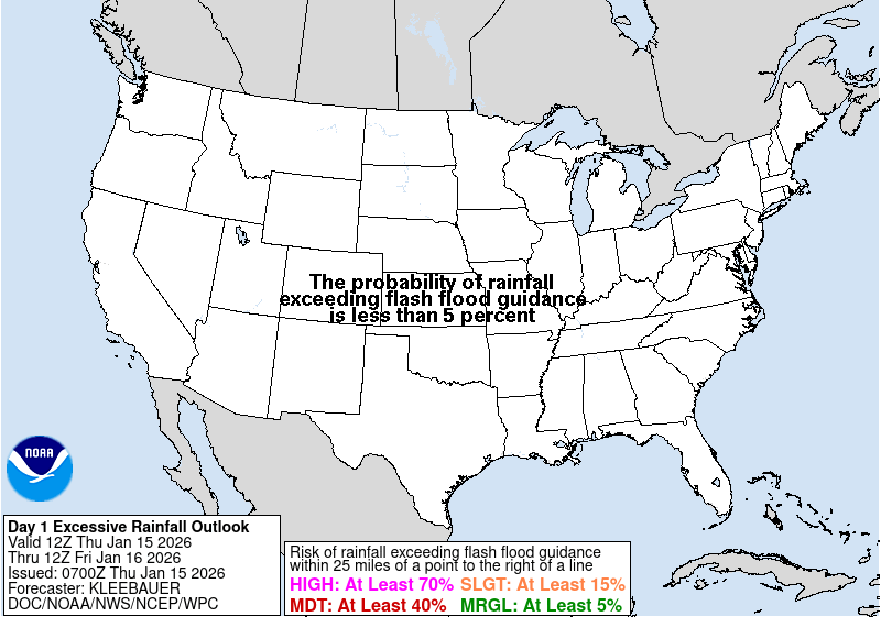
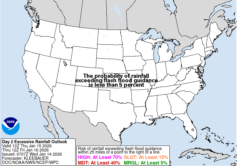
Excessive rainfall outlook
Chance that rain will cause flash flooding, NOAA Weather Prediction Center